 Korouoma Canyon
Korouoma Frozen Waterfalls Map and Icefall Inventory
Last reviewed September 2026
This Korouoma frozen waterfalls map plots what is actually fixed on the ground: the Saukkovaara trailhead, the cafe beside it, the two canyon lean-tos where every guided group eats, the Piippukallio cliff and Ruskea virta, the highest ice in the canyon. Under it is the full inventory of all six named icefalls with the heights, widths and angles Metsahallitus publishes, in the order you meet them walking the loop clockwise. Nobody else prints both.
Quick answer Six named walls, one 4.6 km loop, and where the fire is
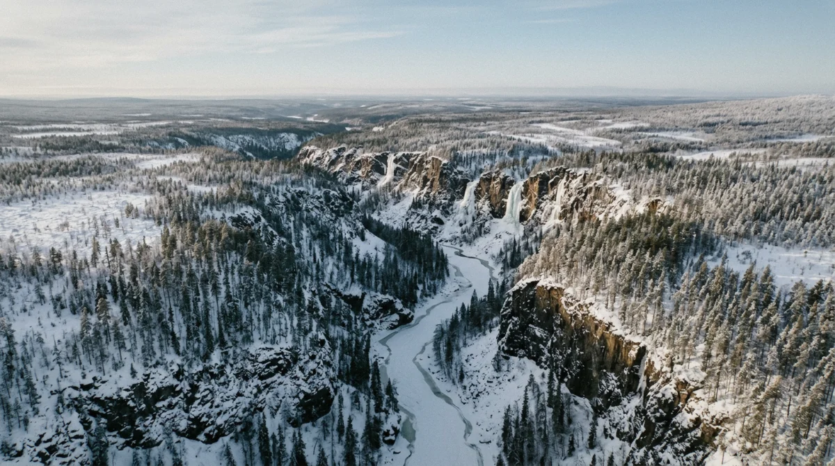
The frozen waterfalls sit along roughly 1.5 kilometres of the canyon's south wall, west of the Saukkovaara car park at Saukkovaarantie 35. Walking the loop clockwise you meet Revontuliputous, Tuulen tie, Jaska Jokunen, Onnekas, Mammutti and finally Ruskea virta, the largest at 35 to 60 metres. The two Kanjonilaavu shelters, where guided groups light their fire, sit between Mammutti and the eastern end of the wall.
Key takeaways
- Trailhead: Saukkovaara car park, charged by the hour since 1 September 2026
- Ruskea virta is the highest ice here and the last to melt, at the turn of May and June
- The fire stop is the Kanjonilaavu shelters, down in the canyon
- Every guided Korouoma departure walks this same line of walls
- Full route detail is in the walking guide
The Canyon, Pinned
Every pin below is a mapped feature on the ground: the car park, the cafe, the shelters, the cliff and the one icefall that carries its own name in the map data. The other five walls are listed under the map with the reserve's own measurements, because Metsahallitus publishes their dimensions but not their coordinates.
All Six Icefalls, in Walking Order
What the reserve measured
Metsahallitus publishes the dimensions of every named wall on the Koronjaa loop, which is more than any tour listing or guidebook does. Walking clockwise, this is the order they arrive in and what you are looking at.
| Order | Icefall | Wall height | Width | Angle | How often it forms |
|---|---|---|---|---|---|
| 1 | Revontuliputous (Northern Light Fall) | About 40 m | 5 to 10 m | 80 to 90 degrees | Thin and flaky most years; the water mostly runs in late autumn |
| 2 | Tuulen tie (the Winds Way) | About 40 m | 80 to 100 m | 85 degrees | Forms, but not climbable every winter |
| 3 | Jaska Jokunen (Charlie Brown) | About 50 m | 20 to 60 m | 50 to 90 degrees | Usually; some winters it hollows into an ice cave |
| 4 | Onnekas (Lucky One) | About 50 m | 20 to 25 m | 80 to 90 degrees | Infrequently, about 100 m upstream of Mammutti |
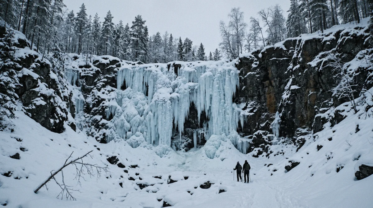
| 5 | Mammutti (the Mammoth Fall) | 35 to 50 m | 40 m | 50 to 90 degrees | Reliably, and blue: the brook is spring-fed |
| 6 | Ruskea virta (Brown River) | 35 to 60 m | 40 m | 70 to 90 degrees | Reliably, with strong flow all winter |
Why three of them are a lottery
The difference is where the water comes from. Mammutti is fed by a brook rising on the slopes of Yli-Voho Hill whose flow is mostly spring water, so it runs clear and cold all winter and freezes into dense blue ice. Ruskea virta has the strongest flow in the canyon and takes its brown from iron in the water.
The other four depend on surface run-off, which stops once the ground freezes. Revontuliputous and Jaska Jokunen carry water mainly in late autumn, which is why their ice is thin most years. Onnekas forms only some winters. Tuulen tie hangs in thin vertical fingers across a very wide face and is not climbable every season.
So the answer to how many frozen waterfalls you will see is between three and six, and it was decided by last October's rain.
Reading the Map Before You Go
The loop is short and the geography is simple
Everything on the icefall walk sits within about a kilometre and a half of the car park, on the south side of the canyon. You drop off the rim near the trailhead, walk west along the wall past the falls, pass the Kanjonilaavu shelters, reach Piippukallio at the far end, and climb back. The official trail page gives the loop as 4.6 kilometres, one to two hours of walking, graded Hard, with a recommended clockwise direction.
The northern pin on the map, Koivukongas, is a different place: five kilometres away, the trailhead for the 17.6 km long trail, and not where any icefall tour goes.
Where the pins came from, and what is missing
The pins are mapped features rather than estimates: the car park, the cafe, the two Kanjonilaavu shelters, the Piippukota rental hut, Piippukallio and Ruskea virta all exist in the map data with their own names. Five of the six icefalls do not, which is why they appear in the table above rather than as coordinates on the map.
The practical consequence for a self-drive visit is that the walls are found by walking rather than by navigating: they are strung along one wall, in the order the reserve lists them, and the trail passes each in turn. Parking to reach them costs a euro an hour, up to five a day, since 1 September 2026.
The Rest of the Canyon, and Why Nobody Walks It
Thirty kilometres, one and a half of them visited
Korouoma runs for thirty kilometres as a fracture in the bedrock, and the entire commercial and recreational life of it happens along roughly a kilometre and a half of the south wall west of one car park. The rest is trailless forest, mire and cliff, with a long marked route threading part of it in summer and nothing at all in winter.
That concentration is the reason a place taking 66,300 visitors a year can still feel empty at nine in the morning and crowded at midday. Everybody is standing in the same short stretch, because that is where the ice is and where the path goes.
What the northern end has instead
Around the Koivukongas car park, five kilometres north of the icefalls, the reserve looks different: the Korojoki running over rapids rather than dropping off a wall, lean-tos strung along a long-distance trail, and the Koivukongas fall itself. It is the summer half of Korouoma, and it is where the 17.6-kilometre hiking route starts.
Metsahallitus ended firewood supply and toilet maintenance at three lean-tos in that half of the reserve in June 2025, which tells you something about the traffic: the winter icefall trail is the part that gets the visitors, the maintenance and now the parking charge.
Where the map ends and the reserve continues
The pins on this page stop at the edge of the day loop because that is where verifiable detail stops. Beyond them the canyon has dozens of smaller icefalls, none named on any public map, some of them known to climbers and none of them reached by a trail.
If that is the version of Korouoma you want, it is a summer proposition with a compass, and the summer and autumn guide sets out what the long trail involves. For the ice, the loop on this map is the whole story, and every departure listed here walks it.
Which Tours Reach Which Pins
The same line of walls, at different speeds
Every guided departure walks the same loop, so the difference is how much of the wall you cover and how long you stand at the fire.
| Tour | Time in the canyon | Reaches Ruskea virta? | Eats at |
|---|---|---|---|
| Arctic GM small group | About 4 hours | Yes | Kanjonilaavu fire pits |
| Wild about Lapland day tour | About 4 hours | Yes | Campfire snack at the lean-tos |
| ToTheNorth hike | 2.5 hours | Yes, at pace | Picnic fire, 30 minutes |
| Beyond Arctic photo hike | 3.5 hours | Yes | Lean-to shelter |
| Korouoma and Auttikongas | About 2 hours, shortened | Not always | Open-fire BBQ |
If you are walking it yourself
Park at Saukkovaara, take the loop clockwise, and give yourself three hours rather than the two the sign suggests, because the stops are what you came for. Grips on your boots, water in the pack, and a bag for whatever you carry in.
The full route description covers the descent, the surface month by month and what is at the trailhead. If you would rather someone else drove and lit the fire, compare the guided departures.
The Map and the Icefalls: Common Questions
How many frozen waterfalls are there at Korouoma?
Six are named on the day loop and Metsahallitus publishes measurements for all of them. Dozens more form along the thirty kilometres of canyon, most of them small and away from any trail. In a given winter three of the six named walls are reliable and three depend on the autumn rainfall.
Which is the biggest icefall at Korouoma?
Ruskea virta at Piippukallio, whose wall runs 35 to 60 metres with middle climbing routes around sixty. It also holds ice longest, usually into the turn of May and June, because its water flow is strong all winter.
Where exactly does the trail start?
At the Saukkovaara car park, nearest address Saukkovaarantie 35, 97815 Posio. It is ploughed and maintained all year, and it is a different trailhead from Koivukongas five kilometres north, which serves the long hiking trail.
Can I see all six icefalls in one walk?
If all six have formed, yes: they sit along about 1.5 kilometres of the same wall and the loop passes each in turn. The three unreliable ones may be a smear of ice or nothing at all, which is a question about last autumn rather than about your route.
Is there a printed map at the trailhead?
There are information boards and a map board beside the car park, and the trail is marked in the terrain as a circle route with a recommended clockwise direction. Mobile coverage in the canyon is patchy, so download or print before you leave Rovaniemi.
Where do the guided groups have lunch?
At the Kanjonilaavu shelters and fire pits down in the canyon, between Mammutti and the eastern end of the wall. They are public, shared, and busy at midday when several vans have arrived within an hour of each other.