 Korouoma Canyon
Korouoma Canyon Hike: Walking the Koronjaa Loop
Last reviewed September 2026
The Korouoma canyon hike is one trail: the Koronjaa loop, 4.6 kilometres from the Saukkovaara car park, graded Hard by Metsahallitus and best walked clockwise. It drops off the canyon rim on a roped pitch, runs flat along the frozen Korojoki past six named icefalls, and climbs back out in one steady pull at the end. Every guided departure on this site walks it, and so can you, with grips on your boots and an honest look at the descent. Here is the route, the surface, the facilities that no longer exist, and where a guide is worth paying for.
Quick answer 4.6 km, graded Hard, and the one piece of kit the reserve says you need
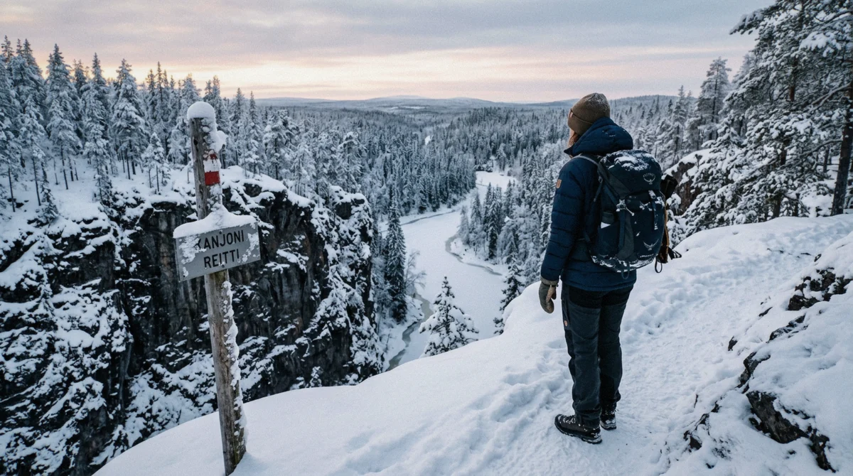
The Koronjaa Trail is 4.6 km, takes one to two hours of walking without stops and three to four with them, and is graded Hard by Metsahallitus. It is a circle trail with a recommended clockwise direction, it gets no winter maintenance, and the agency states plainly that in winter it is dangerously slippery and ice grippers are needed. Entry is free and there is no gate, though parking at Saukkovaara is charged from 1 September 2026.
Key takeaways
- 4.6 km loop from Saukkovaara, walked clockwise so the icefalls build to the biggest
- Officially graded Hard, the descent and the final climb are why. Which Korouoma tours shorten it
- Ice grips are not optional in winter; several listings supply them
- No water point, no bins, and the dry toilet is no longer maintained
- Free to walk; Saukkovaara parking is charged from 1 September 2026
The Route, in the Order You Walk It
Clockwise, and why it matters
Metsahallitus marks the Koronjaa Trail as a circle with a recommended direction of travel: clockwise. Two things follow from that. The icefalls arrive in ascending order, finishing at Ruskea virta, the largest and highest in the canyon. And the steep descent comes early, while your legs are fresh and before the light has started to go.
Walk it the other way and you meet the best wall first, then spend two hours on progressively smaller ice, and take the steep pitch as a climb at the end of the day instead of a controlled descent at the start of it.
From the car park to the rim
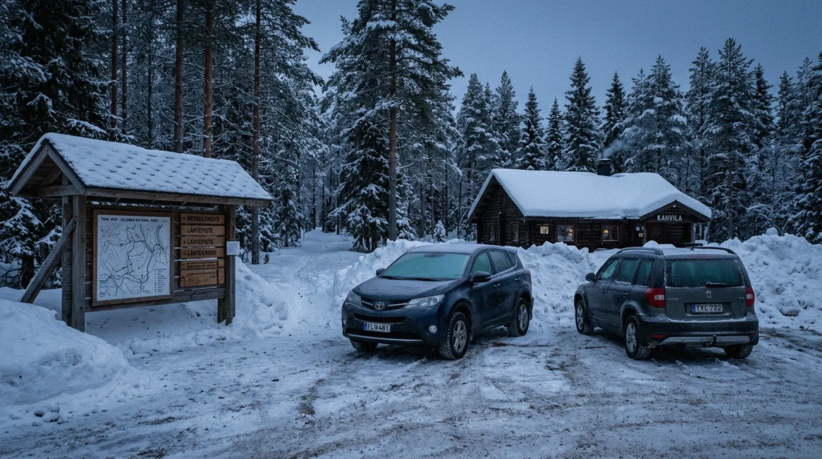
The trail starts at the Saukkovaara car park, past the wooden cabin that houses the Korouoman Erakahvila cafe and under an information pavilion whose boards are worth two minutes. The first half-kilometre is flat forest walking on an old horse road, used historically for hauling timber, which is why the gradient is so even.
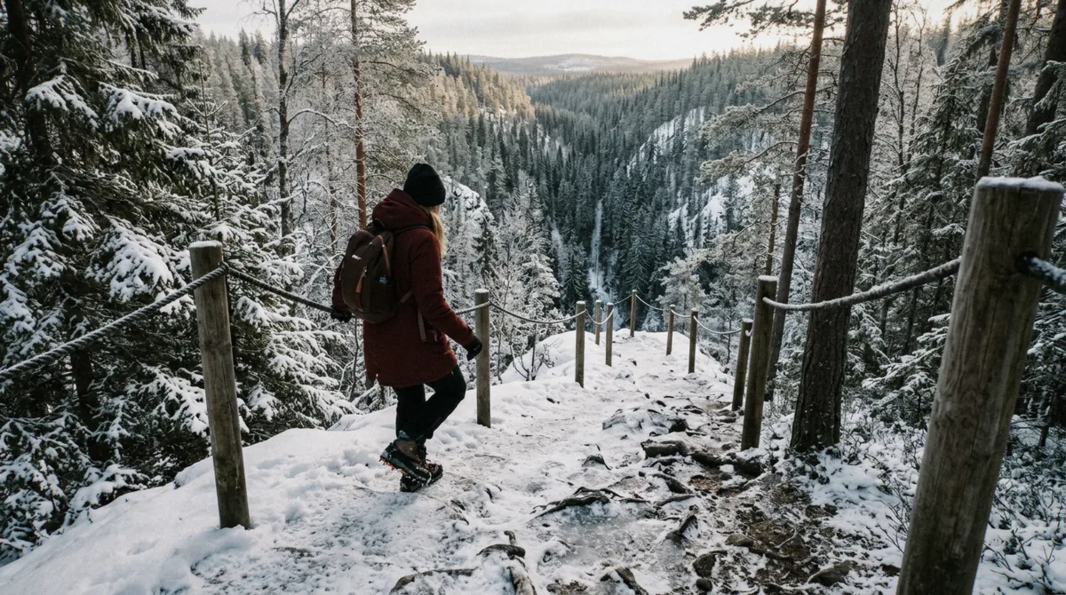
Then the ground tips. The descent into the canyon is the crux of the walk: a steep pitch with a rope strung along it, snow-covered in midwinter and polished ice by April. Take it sideways, facing the rope, one at a time. Guided groups do exactly this, and the fixed rope is the reason a group of eight takes ten minutes over a hundred metres of trail.
Along the canyon floor
At the bottom you cross the Korojoki and turn along the wall. This is the flat, easy, spectacular part, a kilometre and a half with the cliffs on one side and the frozen river on the other, and six named icefalls hanging off the rock at intervals.
The reserve asks visitors not to walk in under them. Ice blocks and stones come off the walls, which is also why ice climbers are watched from a distance rather than from the base. Viewpoints along the trail are set back deliberately; the photograph you want is from there anyway, because up close you lose the scale.
The fire pits, and the climb out
Past Ruskea virta the trail reaches an area of communal fire pits and a lean-to. Some are reserved for tour groups, the rest are open to anyone, and this is where every guided lunch on this site happens.
From there the trail turns uphill and climbs back to the rim in one steady ascent of roughly a kilometre. This is the section reviewers on every listing single out. It is not technical and it is not long; it is simply the last thing you do, in a snowsuit, after three hours in the cold.
The Numbers, and Who Publishes Which
Reserve figures against operator figures
The trail data below comes from Metsahallitus, which manages the reserve; the walking times come from the tour listings, which describe the same route with a guide setting the pace. Where they disagree, the reserve is describing the trail and the operator is describing the day.
| Metsahallitus | Tour listings | What to plan for | |
|---|---|---|---|
| Koronjaa loop | 4.6 km, 1-2 h, graded Hard | 4 to 6 km, moderate fitness | 5 km and three hours with stops |
| Winter maintenance | None; grippers needed | Grips supplied on some listings | Rent a pair if your tour does not supply them |
| Descent | Steep, roped section | Rarely mentioned | The crux of the walk, taken slowly |
| Toilets | Dry toilet, no longer maintained | Trailhead stop before the trail | Bring your own paper |
| Long trail | 17.6 km, 1-2 days, snow-free season only | Not sold in winter | Summer only |
What is not at the trailhead any more
Since 1 June 2025 Metsahallitus has ended firewood supply and toilet maintenance at the Kangaslampi, Koivukongas and Iso-Kuulea lean-tos, along with the Iso-Kuulea day-use hut. Those sit in the northern half of the reserve, on the long trail. The Kanjonin laavut, the lean-tos and fire pits on this loop, are among the sites still maintained.
In practice: check the woodshed rather than count on it, and if it is empty the wood comes with you. There is also no water point and no waste bin anywhere on the loop, so carry water in and rubbish out. The Korouoman Erakahvila cafe at the trailhead sells hot drinks and pastries and rents ice cleats, but it keeps small-business hours and may not be open before an early winter walk.
The Six Icefalls, and Which Ones Actually Show Up
What stands where
Walking clockwise, the ice comes in this order, with the measurements Metsahallitus publishes for each wall. Three of the six are conditional: they depend on how much water ran in late autumn and how early the frost set.
| Icefall | Height of the wall | Width | Reliable? |
|---|---|---|---|
| Revontuliputous (Northern Light Fall) | About 40 m | 5 to 10 m | Thin and flaky most years |
| Tuulen tie (the Winds Way) | About 40 m | 80 to 100 m | Forms, but not climbable every winter |
| Jaska Jokunen (Charlie Brown) | About 50 m | 20 to 60 m | Usually; occasionally hollows into an ice cave |
| Onnekas (Lucky One) | About 50 m | 20 to 25 m | Forms infrequently |
| Mammutti (the Mammoth Fall) | 35 to 50 m | 40 m | Yes, and spring-fed, so the ice runs blue |
| Ruskea virta (Brown River) | 35 to 60 m | 40 m | Yes, strong flow all winter, the highest here |
What that means on the day
On a good January the whole line is standing and the walk delivers six walls of ice in an hour and a half. In a mild autumn with little rain, Revontuliputous is a smear and Onnekas is absent, and you have three: Jaska Jokunen, Mammutti and Ruskea virta.
Those three are the reason the trail exists. Mammutti takes its blue from a spring on the slopes of Yli-Voho Hill, which feeds it clear water all winter rather than the tea-coloured bog water that stains Ruskea virta orange-brown. Standing between them, forty metres apart on the same wall, is the single best thing on this walk. The full inventory with the map is on the icefall page.
What the Trail Is Actually Like, Month by Month
Snow, then glass
In December and January the surface is mostly compacted snow, which grips reasonably well and forgives a slip. By March the same path has been walked by thousands of boots and refrozen every night, and the steep sections turn to polished ice. April adds meltwater in the daytime and a fresh glaze every morning.
This is why the reserve's warning is seasonal in tone but absolute in substance: the trail is never maintained for winter, and the grip you have is the grip you brought. Reviewers of the guided tours describe guides telling groups to trust their crampons, good advice if you are wearing a pair.
Daylight, and the honest planning number
Rovaniemi and Posio sit far enough north that the sun does not rise at all between roughly 3 December and 9 January. Twilight still lights the canyon for a few hours around midday, and it is beautiful, but the practical planning number in December is that you want to be walking by half past ten and out by two.
From February the window opens fast, and by late March there is more daylight than you can use. The season guide breaks it down month by month.
Walking It Alone, or With a Guide
The honest split
A confident winter walker with grips, warm layers and a rented car can do this loop unguided and enjoy it more for the solitude. Someone on their first Arctic trip, in January, without cleats, driving a rental on a forest road in the dark, is buying a different day than they think they are.
The listings answer this in three ways.
| How you go | What it costs | What you take on | Best for |
|---|---|---|---|
| Own car | Rental day plus fuel for 210 km | Driving, grips, wood, parking, judging the ice | Two or more with winter driving experience |
| Self-guided coach | The cheapest seat here | Walking the loop alone after a briefing | Confident walkers without a car |
| Guided hike | From the low end of the guided range | Nothing, grips, food and route are handled | First Arctic winter hike, or short on time |
| Family-paced day | Mid-range | A shortened canyon walk plus a second waterfall | Children from four |
Where the guides actually earn it
Three places. The descent, where they take a group down one at a time and pick the line. The ice, where they know which of the six falls has formed this winter and which has not. And the fire, where the wood, the grill and the hot drink appear without anyone carrying them 105 kilometres.
Everything else, the route, the direction, the viewpoints, is signposted and public. That is worth saying plainly on a site that earns its money from the bookings: the trail is free, the loop is walkable, and the guide is a convenience and a safety margin rather than a key to a locked door. Compare what each departure includes before deciding which side of that line you are on.
Korouoma Canyon Hike: Common Questions
How long does the Korouoma hike take?
Metsahallitus gives the Koronjaa loop as one to two hours for 4.6 kilometres, which is a walking time with no stops. With photographs, a fire and time under the big walls, three to four hours is realistic, which is exactly the range the guided tours schedule.
Do I need crampons or microspikes?
In winter, yes. The trail has no winter maintenance and the reserve states that it is dangerously slippery and that ice grippers are needed. Simple strap-on cleats are enough; mountaineering crampons are not required. Several tours supply them, and the gear guide covers renting a pair in Rovaniemi.
Is there an entrance fee for Korouoma?
No. It is a Metsahallitus nature reserve with no gate, no ticket and no charge to park at Saukkovaara. What costs money is getting there, which is why the guided departures exist at all.
Can you walk the canyon in the dark?
People do, with head torches, and in December the middle of the day is twilight anyway. It is not recommended on a first visit: the descent is the hazard, and the trail markers are easier to lose under fresh snow than they look on a summer photograph.
Is the trail suitable for children?
The full loop is graded Hard and involves a roped descent, so it suits older children who walk confidently. Younger ones are better served by the shortened family day, which cuts the canyon section and adds an easier waterfall trail.
What about dogs?
Dogs are allowed on a leash across the reserve, and the visitor rules ask that waste is cleaned away from the paths. The descent in ice is the part to think about, a dog that pulls on a roped pitch is a problem for everyone on it.